


Parrot
Parrot - ANAFI USA.GOV
Parrot - ANAFI USA.GOV
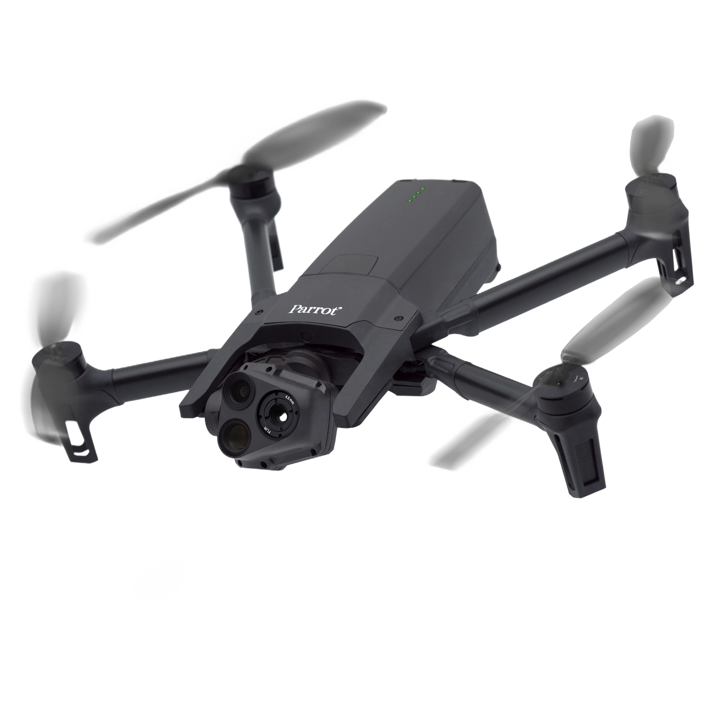
ANAFI USA is a powerful drone built to meet the demands of first responders, firefighters, search-and-rescue teams, security agencies, surveying and inspection professionals. Featuring an industry-first 32x zoom, 4K HDR video and thermal imaging capabilities, ANAFI USA is an ultraportable, secure and durable aerial camera platform.
Features
- Blue sUAS program approved
- NDAA & TAA compliant
- 32x zoom
- Thermal camera
- Flight ready in 55 sec
- Cybersecurity – Made in the USA
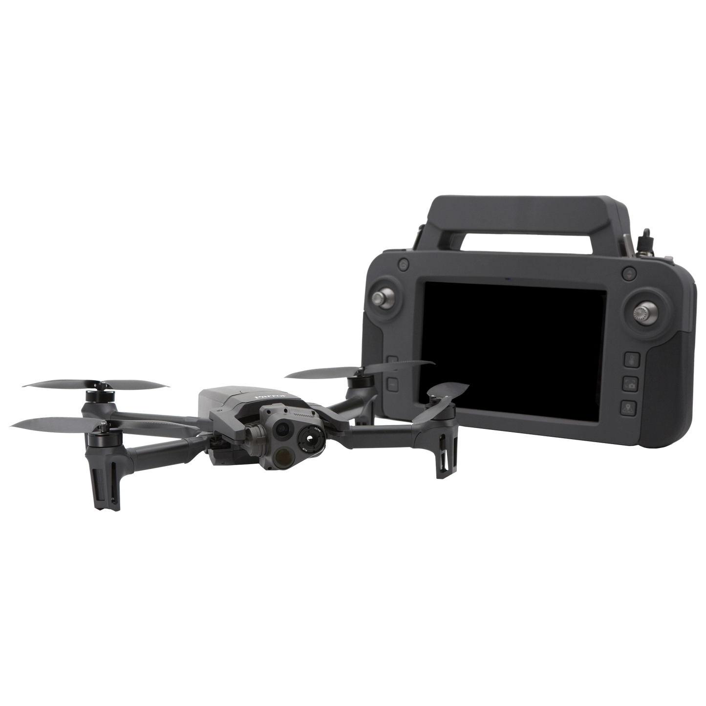
What's in the box?
- 1 ANAFI USA_GOV Drone
- 3 smart batteries (3x32 minutes)
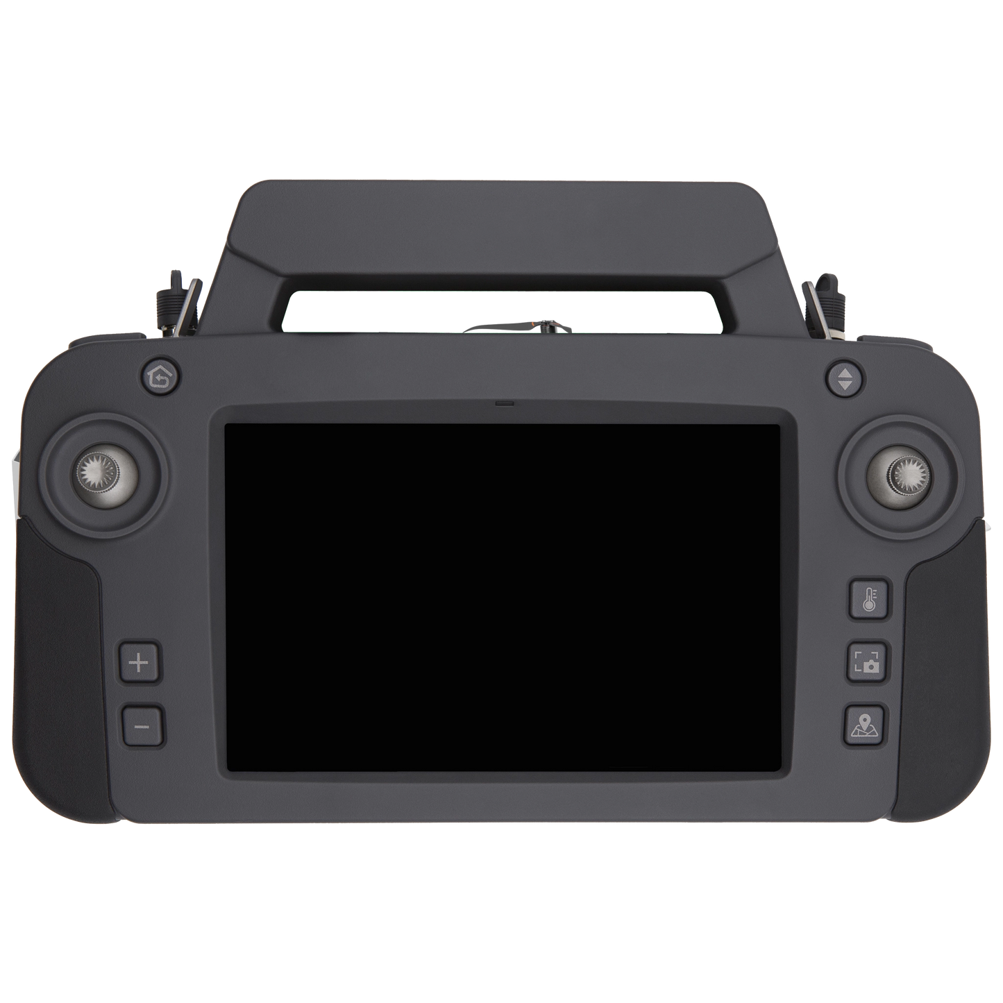
- 1 Skycontroller USA with its 8-inch display
- 1 multi-port fast USB charger
- 1 Skycontroller USA charger
- 1 additional set of propeller blades
- 3 USB-A/USB-C cables
- 1 Hard Case
Specs
DRONE
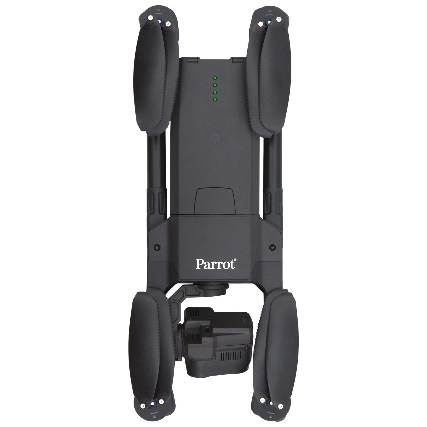
- Size folded: 252 x 104 x 84 mm
- Size unfolded: 282 x 373 x 82 mm
- Size unfolded on MIL version: 282 x 373 x 192 mm
- Mass: 500 g / 1.10 lb
- Maximum take-off mass (MTOM): 644 g / 1.42 lb.
- Maximum flight time: 32 minutes (30 minutes on MIL version)
- Maximum horizontal speed: 14.7 m/s
- Maximum ascent speed: 4 m/s (6 m/s on unlocked SE, GOV and MIL versions)
- Maximum descent speed: 3 m/s
- Maximum wind resistance: 14.7 m/s
- Maximum propeller speed: 11,000 rpm
- Sound power level at 1 m (3 ft): 84 dB
- Service ceiling: 5,000 m above MSL (Mean Sea Level)
- User defined geofencing
- IP53 certified: dust and rain resistant
- Operating temperature: -33 °F (-36 °C) to +122 °F (+50 °C)
- No take-off temperature limitations
SECURITY
- Zero data shared by default
- SD card AES-XTS encryption with a 512 bits key
- WPA2 AES CCMP encrypted network connections
- Digitally signed firmware
SENSORS
- Satellite navigation: GPS, GLONASS & GALILEO
- Barometer and magnetometer
- Vertical camera and ultra-sonar
- 2 x 6-axis IMU
- 2 x 3-axis accelerometers
- 2 x 3-axis gyroscopes
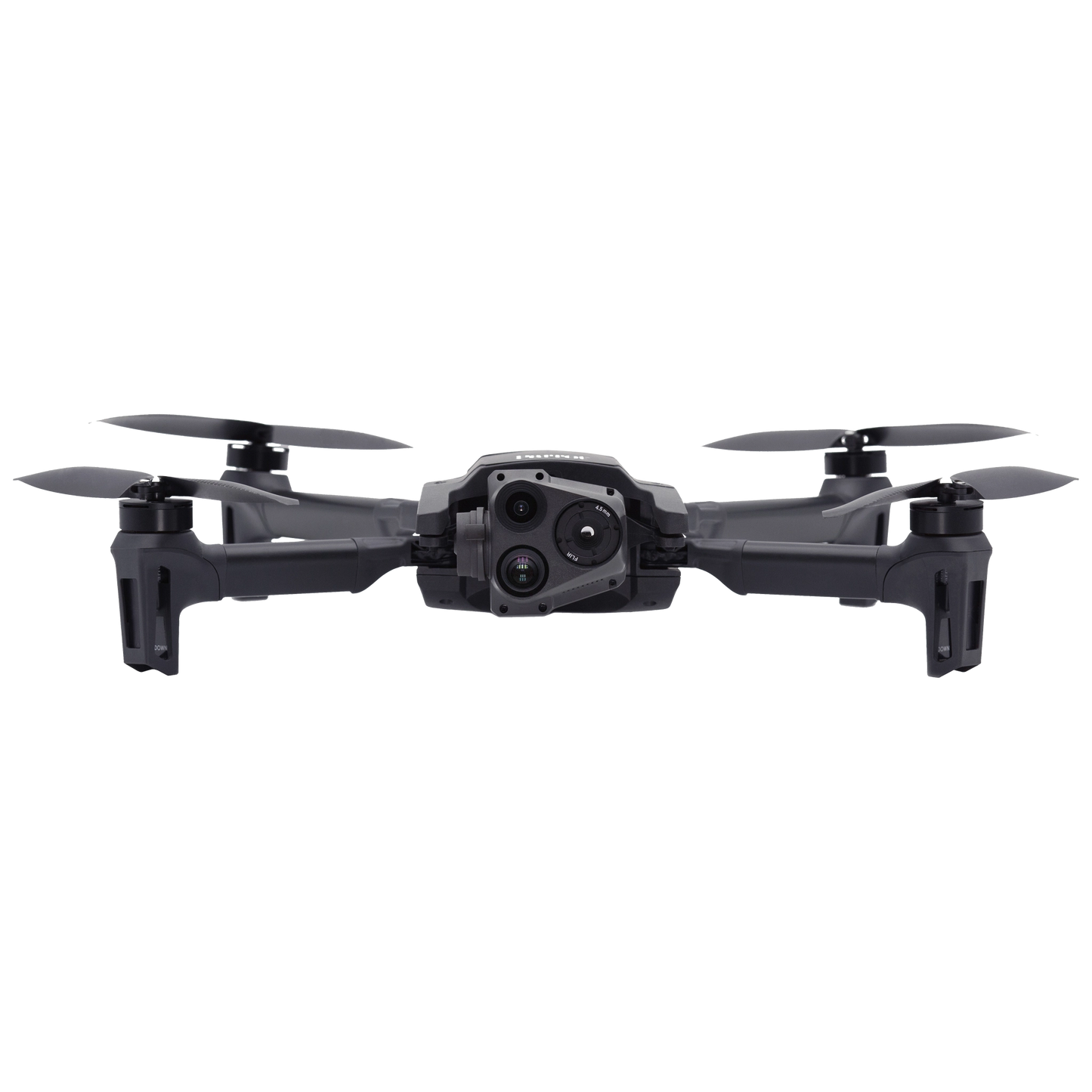
EO IMAGE CHAIN
- 2 sensors: 1/2.4’’
- Digital zoom: 32x
- Electronic shutter speed: 1 s to 1/10,000 s
- ISO range: 100 – 3200
- Video resolution: 4K/FHD/HD
- Video format: MP4 (H.264)
- Photo resolutions: Wide: 21 MP (84° FOV) / Rectilinear: up to 16 MP (up to 75.5° FOV)
- Photo formats: JPEG, DNG (Digital NeGative RAW)
IR IMAGE CHAIN
- Sensor: FLIR BOSON
- Digital zoom: 32x -40 °C to +150 °C temperature range
- Thermal sensitivity: ≤60 mK
- Measured IR wavelength range: 7.5 to 13 micrometers
- Video resolution: 1280 x 720 px
- Video format: MP4 (H.264)
- Framerate: 9 fps
- Photo resolution: 320 x 256 px
- Photo format: JPEG IMAGE STABILIZATION
- 3-camera IR/EO stabilized gimbal: Hybrid: 3-axis / Mechanical: 2-axis roll / pitch / Electronics (EIS): 3-axis pitch / roll / yaw Controllable gimbal tilt range: -90° to +90°
Please note, prices are susceptible to variations. The sales team at RMUS Canada can be contacted through email sales@rmus.ca or you can call us (416) 303-3575.
Share
Why RMUS Canada
-
- Gold Tier DJI Enterprise Dealer
- DJI Certified Maintenance and Service Provider
- DJI Dock Certified
- RMUS Hub online training center
-
- Certified Training instructors - former Public Safety RPAS operators
- Emergency Equipment Loaner Program
- Trade in credits available
RMUS Canada Resources
-
Sourcewell
RMUS has an existing contract with Sourcewell, a government agency that helps to make the buying process easier and faster.
-
Sourcewell combines the purchasing power of multiple agencies into one cooperative group that helps to streamline the procurement process for governmental agencies such as Public Safety and Educational agencies.
-
Consult our sales team to learn more about Sourcewell and how to use it to its fullest power.
For more information visit: Sourcewell